
RAC Investigation into Agricultural Drainage to Inform Gwent Levels Sustainable Management Scheme

RAC is carrying out an investigation into agricultural drainage in the Gwent Levels to inform the Sustaining the Gwent Levels, Sustainable Management Scheme Project. The project is funded through the Welsh Government Rural Communities – Rural Development Scheme 2014-2020, which is funded by the Welsh Government and the European Union.
The Gwent Levels comprise a series of six Sites of Special Scientific Interest (SSSIs) covering most of the coastal area between Cardiff and Chepstow including associated tidal mudflats they form the most extensive area of wet pasture in Wales. Comparable sites in England are the Somerset Levels, Romney Marsh and the Kent and Essex Marshes.
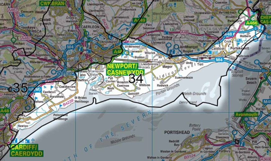
The Levels are entirely man-made with much of them below mean high water and the sea kept out by sea walls and banks. Traditionally fields in the Levels drained by a system of ridge and furrow connected by grips draining into the extensive system of interconnected ditches surrounding fields and on into a network of larger watercourses, known as reens, which eventually discharge to the Severn Estuary through tidal flaps. The system drains entirely by gravity.
The SSSIs were notified because of the range of aquatic plants and invertebrates associated with the water in the reens and field ditches of the drainage system. The survival of these features depends on sympathetic land and water management land and so the land in-between the watercourses is included within the SSSI boundaries.
Water levels in the Levels are managed by Natural Resources Wales using boards and sluices in the reens. In the summer, water levels are kept high in the ditches to provide water for livestock, field boundaries and irrigation, but in winter the boards are removed to drain water into the Severn Estuary and prevent land being flooded.
The main reens are maintained by dredging and de-weeding to maintain flood storage and water flows. The maintenance of field ditches is the responsibility of individual landowners.
The Gwent Levels are also included in the Register of Landscapes of Historic Interest in Wales. This recognises the Gwent Levels as one of the most significant historic landscapes in Wales. The quality of this rich historical and archaeological resource also makes it of certain international significance.
The project aims to understand what changes to land use and agricultural practice, and modern underdrainage would bring, including costs and benefits for farmers, and how this compares with maintaining a traditional gripped drainage system. This includes anticipating how farming practices are likely to change as a result of installing new underdrainage.
The sustainable future of the Levels will be considered in terms of Improvements in economic wellbeing which may result from increasing the productive capacity of the land, whilst ensuring that change does not result in a negative impact on other wellbeing pillars such as social, cultural and environmental. If new land management opportunities are adopted at the expense of the ecosystem resilience in the area then this may impact the area’s ability to provide other vital ecosystems services including flood regulation, water quality regulation, climate regulation and culturally specific services.
This Case Study will be developed as the project progresses towards it conclusion in September 2021.